This article needs additional citations for verification. (July 2011) |
| Waterloo South Australia | |||||||||||||||
|---|---|---|---|---|---|---|---|---|---|---|---|---|---|---|---|
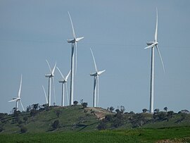
 The Waterloo windfarm looking southwest along the Tothill Range | |||||||||||||||
| Coordinates | 33°59′31″S 138°52′45″E / 33.992050°S 138.879240°E | ||||||||||||||
| Population | 82 (SAL 2016)[1][2] | ||||||||||||||
| Established | 1865 | ||||||||||||||
| Postcode(s) | 5413[3] | ||||||||||||||
| Location |
| ||||||||||||||
| LGA(s) | District Council of Clare and Gilbert Valleys | ||||||||||||||
| State electorate(s) | Frome, Goyder | ||||||||||||||
| Federal division(s) | Grey | ||||||||||||||
| |||||||||||||||
| Footnotes | Coordinates[4] | ||||||||||||||
Waterloo is a settlement in South Australia, located just off the Barrier Highway between Manoora and Black Springs, approximately 121 kilometres (75 mi) north-east of the state capital of Adelaide.[5]
- ^ Australian Bureau of Statistics (27 June 2017). "Waterloo (suburb and locality)". Australian Census 2016.
- ^ Australian Bureau of Statistics (27 June 2017). "Waterloo (SA) (suburb and locality)". Australian Census 2016 QuickStats. Retrieved 28 June 2022.
- ^ "Waterloo Postcode". Australian Postcode Search. Retrieved 5 November 2015.
- ^ "Search result for "Waterloo (Locality Bounded)" (Record no SA0018595)". Department of Planning, Transport and Infrastructure. Retrieved 5 November 2015.
- ^ "2905.0 – Statistical Geography: Volume 2 – Census Geographic Areas, Australia, 2006". Australian Bureau of Statistics. 17 July 2007. Retrieved 1 July 2011.
