Watervliet | |
|---|---|
 Watervliet as seen when entering the city on Congress Street Bridge from Troy | |
| Etymology: from Dutch 'water brook, water stream' | |
| Nickname: The Arsenal City | |
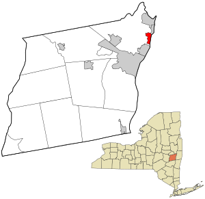
 Location in Albany County and the state of New York. | |
 Location of New York in the United States | |
| Coordinates: 42°43′29″N 73°42′22″W / 42.72472°N 73.70611°W | |
| Country | United States |
| State | New York |
| County | Albany |
| Incorporation as city | 1896 |
| Government | |
| • Type | City Hall |
| • Mayor | Charles Patricelli (D) |
| • General Manager | Joseph LaCivita |
| Area | |
| • Total | 1.47 sq mi (3.81 km2) |
| • Land | 1.34 sq mi (3.48 km2) |
| • Water | 0.13 sq mi (0.34 km2) |
| Elevation | 30 ft (9 m) |
| Lowest elevation | 0 ft (0 m) |
| Population (2020) | |
| • Total | 10,375 |
| • Density | 7,731.00/sq mi (2,985.58/km2) |
| Time zone | UTC-5 (EST) |
| • Summer (DST) | UTC-4 (EDT) |
| ZIP Code | 12189 |
| Area code | 518 |
| FIPS code | 36-001-78674 |
| FIPS code | 36-78674[2] |
| GNIS feature ID | 0968918[3] |
| Wikimedia Commons | Watervliet, New York |
| Website | www |
Watervliet (/wɔːtərˈvliːt/ waw-tər-VLEET or /wɔːtərvəˈliːt/ waw-tər-və-LEET) is a city in northeastern Albany County, New York, United States. The population was 10,375 as of the 2020 census.[4] Watervliet is north of Albany, the capital of the state, and is bordered on the north, west, and south by the town of Colonie. The city is also known as "the Arsenal City".[5]
- ^ "ArcGIS REST Services Directory". United States Census Bureau. Retrieved September 20, 2022.
- ^ "U.S. Census website". United States Census Bureau. Retrieved January 31, 2008.
- ^ "US Board on Geographic Names". United States Geological Survey. October 25, 2007. Retrieved January 31, 2008.
- ^ "Geographic Identifiers: 2010 Demographic Profile Data (G001): Watervliet city, New York". U.S. Census Bureau, American Factfinder. Archived from the original on February 12, 2020. Retrieved June 27, 2013.
- ^ Sanzone, Danielle. "Former police chief allegedly stole money from funeral home". The Record.

