Waves, North Carolina | |
|---|---|
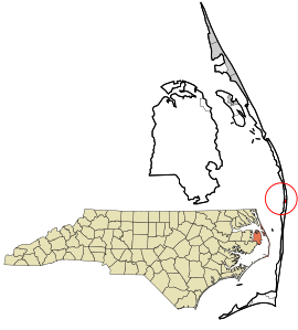
 Location in Dare County and the state of North Carolina | |
| Coordinates: 35°34′0″N 75°28′6″W / 35.56667°N 75.46833°W | |
| Country | United States |
| State | North Carolina |
| County | Dare |
| Named for | Wind waves |
| Area | |
• Total | 0.69 sq mi (1.78 km2) |
| • Land | 0.68 sq mi (1.75 km2) |
| • Water | 0.01 sq mi (0.03 km2) |
| Elevation | 5 ft (2 m) |
| Population (2020) | |
• Total | 172 |
| • Density | 254.81/sq mi (98.38/km2) |
| Time zone | UTC-5 (Eastern (EST)) |
| • Summer (DST) | UTC-4 (EST) |
| ZIP code | 27982 |
| FIPS code | 37-71440 |
| GNIS feature ID | 1023135[2] |
Waves is an unincorporated community and census-designated place (CDP) in Dare County, North Carolina, United States. It is on Hatteras Island, part of North Carolina's Outer Banks. As of the 2010 census it had a population of 134.[3] Waves, along with Rodanthe and Salvo, are part of the settlement of Chicamacomico.
The residents of Waves are governed by the Dare County Board of Commissioners. Waves is part of District 4, along with Avon, Buxton, Frisco, Hatteras, Rodanthe and Salvo.
- ^ "ArcGIS REST Services Directory". United States Census Bureau. Retrieved September 20, 2022.
- ^ U.S. Geological Survey Geographic Names Information System: Waves, North Carolina
- ^ "Geographic Identifiers: 2010 Demographic Profile Data (G001): Waves CDP, North Carolina". U.S. Census Bureau, American Factfinder. Archived from the original on February 13, 2020. Retrieved November 24, 2015.