Weber County | |
|---|---|
 | |
 Location within the U.S. state of Utah | |
 Utah's location within the U.S. | |
| Coordinates: 41°18′N 111°55′W / 41.3°N 111.92°W | |
| Country | |
| State | |
| Founded | January 31, 1850 (created) March 3, 1852 (organized) |
| Named for | John Henry Weber |
| Seat | Ogden |
| Largest city | Ogden |
| Area | |
• Total | 659 sq mi (1,710 km2) |
| • Land | 576 sq mi (1,490 km2) |
| • Water | 83 sq mi (210 km2) 13% |
| Population (2020) | |
• Total | 262,223 |
• Estimate (2021) | 267,066 |
| • Density | 400/sq mi (150/km2) |
| Time zone | UTC−7 (Mountain) |
| • Summer (DST) | UTC−6 (MDT) |
| Congressional district | 1st |
| Website | www |
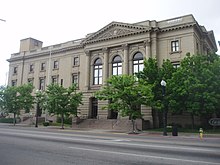
Weber County (/ˈwiːbər/ WEE-bər) is a county in the U.S. state of Utah. As of the 2020 census, the population was 262,223,[1] making it Utah's fourth-most populous county. Its county seat and largest city is Ogden,[2] the home of Weber State University. The county was named after a fur trapper John Weber.
Weber County is part of the Ogden-Clearfield, UT Metropolitan Statistical Area as well as the Salt Lake City-Provo-Ogden, UT Combined Statistical Area.
- ^ "State & County QuickFacts". United States Census Bureau. Retrieved August 16, 2022.
- ^ "Find a County". National Association of Counties. Retrieved June 7, 2011.