| Wenderholm Regional Park | |
|---|---|
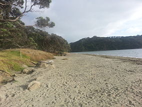
 Wenderholm beach to north | |
| Location | Rodney, Auckland, New Zealand |
| Nearest town | Waiwera |
| Coordinates | 36°32′13″S 174°42′36″E / 36.537°S 174.71°E[1] |
| Area | 135 hectares (330 acres)[2] |
| Established | 1965 |
Wenderholm Regional Park is a regional park north of Auckland in New Zealand's North Island. It is situated between the estuaries of the Puhoi River and the Waiwera River, on the east coast of New Zealand's North Island and features a homestead known as Couldrey House, and a carved pouwhenua.[3]
The park also features the 2 kilometres (1.2 mi) 'Maungatauhoro Te Hikoi' walking track, starting at the carved pouwhenua near the Couldrey House. The track features scenic views and birdlife.[4][5]
Wenderholm Regional Park was the first regional park established in the Auckland region, and is owned and managed by Auckland Council. Part of the park is sectioned off for ecological restoration.[6]
- ^ "Wenderholm Map" (PDF). Auckland Council. Retrieved 15 May 2012.
- ^ Janssen, Peter (January 2021). Greater Auckland Walks. New Holland Publishers. p. 31-32. ISBN 978-1-86966-516-6. Wikidata Q118136068.
- ^ "Wenderholm". Auckland Council. Retrieved 1 September 2011.
- ^ Auckland Regional Park about Maungatauhoro
- ^ Maungatauhoro Te Hikoi at scoopnews
- ^ "Council profile". aucklandcouncil.govt.nz. Auckland Council.
