| Wendlebury | |
|---|---|
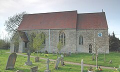
 St Giles' parish church | |
Location within Oxfordshire | |
| Area | 4.65 km2 (1.80 sq mi) |
| Population | 421 (2011 census) |
| • Density | 91/km2 (240/sq mi) |
| OS grid reference | SP5619 |
| Civil parish |
|
| District | |
| Shire county | |
| Region | |
| Country | England |
| Sovereign state | United Kingdom |
| Post town | Bicester |
| Postcode district | OX25 |
| Dialling code | 01869 |
| Police | Thames Valley |
| Fire | Oxfordshire |
| Ambulance | South Central |
| UK Parliament | |
| Website | Wendlebury Village |
Wendlebury is a village and civil parish about 2 miles (3 km) southwest of Bicester and about 1⁄2 mile (800 m) from Junction 9 of the M40. Junction 9 is where the A34 and A41 roads meet the M40, and it is also called the Wendlebury Interchange.[1]
A stream flows through the centre of the village, parallel with the main street. The 2011 census recorded the parish's population as 421.[2]
The toponym is derived from Old English, meaning the burh of a Saxon named Wændel.[3]
- ^ "A34 M40 J9 Wendlebury Interchange". roads.org.uk. Retrieved 19 December 2020.
- ^ "Area: Wendlebury (Parish): Key Figures for 2011 Census: Key Statistics". Neighbourhood Statistics. Office for National Statistics. Retrieved 6 September 2015.
- ^ Lobel 1959, pp. 338–346
