Werkhoven | |
|---|---|
Village | |
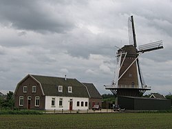
 Windmill near Werkhoven | |
| Coordinates: 52°1′26″N 5°14′35″E / 52.02389°N 5.24306°E | |
| Country | Netherlands |
| Province | Utrecht |
| Municipality | Bunnik |
| Area | |
• Total | 16.78 km2 (6.48 sq mi) |
| Elevation | 4 m (13 ft) |
| Population (2001)[1] | |
• Total | 2,550 |
| • Density | 150/km2 (390/sq mi) |
| Time zone | UTC+1 (CET) |
| • Summer (DST) | UTC+2 (CEST) |
| Postal code | 3985[1] |
| Dialing code | 0343 |
Werkhoven is a town in the Dutch province of Utrecht. It is a part of the municipality of Bunnik, and lies about 5 km east of Houten. Castle Beverweerd is located on the other side of the river.
Werkhoven used to be a separate municipality. It merged with Bunnik and Odijk in 1964.[3]
- ^ a b c "Kerncijfers wijken en buurten 2021". Central Bureau of Statistics. Retrieved 28 March 2022.
two entries
- ^ "Postcodetool for 3985AA". Actueel Hoogtebestand Nederland (in Dutch). Het Waterschapshuis. Retrieved 28 March 2022.
- ^ Cite error: The named reference
plaatswas invoked but never defined (see the help page).


