| Werrikimbe National Park New South Wales | |
|---|---|
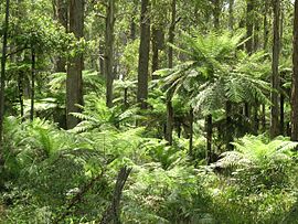
 Tree ferns in Werrikimbe National Park | |
| Nearest town or city | Walcha |
| Coordinates | 31°12′S 152°14′E / 31.200°S 152.233°E |
| Established | 11 July 1975[1] |
| Area | 333 km2 (128.6 sq mi)[1] |
| Managing authorities | NSW National Parks & Wildlife Service |
| Website | Werrikimbe National Park |
| See also | Protected areas of New South Wales |
The Werrikimbe National Park is a protected national park located in the catchment zone of the Upper Hastings River in New South Wales, Australia. Gazetted in 1975, the 33,309-hectare (82,310-acre) park is situated approximately 486 kilometres (302 mi) north of Sydney, 65 kilometres (40 mi) north-west of Wauchope, and 90 kilometres (56 mi) east of Walcha on the eastern escarpment of the Great Dividing Range.
The park is part of the Hastings-Macleay group World Heritage Site Gondwana Rainforests of Australia inscribed in 1986[2] and added to the Australian National Heritage List in 2007.[3]
- ^ a b "Werrikimbe National Park". Office of Environment and Heritage. Government of New South Wales. Retrieved 10 September 2014.
- ^ "Gondwana Rainforests of Australia". Department of the Environment. Australian Government. Retrieved 10 September 2014.
- ^ "Gondwana Rainforests of Australia, Lismore, NSW, Australia". Australian Heritage Database: Department of the Environment. Australian Government. 2014. Retrieved 10 September 2014.
