West Amwell Township, New Jersey | |
|---|---|
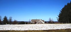
 West Amwell Township Municipal Building | |
 Location of West Amwell Township in Hunterdon County highlighted in yellow (right). Inset map: Location of Hunterdon County in New Jersey highlighted in black (left). | |
 Census Bureau map of West Amwell Township, New Jersey | |
Location in Hunterdon County Location in New Jersey | |
| Coordinates: 40°22′45″N 74°53′16″W / 40.379051°N 74.887735°W[1][2] | |
| Country | |
| State | |
| County | |
| Incorporated | April 6, 1846 |
| Named for | Amwell Township / Great and Little Amwell, Hertfordshire |
| Government | |
| • Type | Township |
| • Body | Township Committee |
| • Mayor | Gary Hoyer (R, term ends December 31, 2023)[3][4] |
| • Municipal clerk | Maria Andrews[5] |
| Area | |
• Total | 21.84 sq mi (56.58 km2) |
| • Land | 21.65 sq mi (56.07 km2) |
| • Water | 0.20 sq mi (0.51 km2) 0.90% |
| • Rank | 129th of 565 in state 12th of 26 in county[1] |
| Elevation | 315 ft (96 m) |
| Population | |
• Total | 3,005 |
• Estimate (2023)[9] | 3,020 |
| • Rank | 449th of 565 in state 17th of 26 in county[10] |
| • Density | 138.8/sq mi (53.6/km2) |
| • Rank | 525th of 565 in state 23rd of 26 in county[10] |
| Time zone | UTC−05:00 (Eastern (EST)) |
| • Summer (DST) | UTC−04:00 (Eastern (EDT)) |
| ZIP Code | 08530 – Lambertville[11] |
| Area code | 609[12] |
| FIPS code | 3401978230[1][13][14] |
| GNIS feature ID | 0882181[1][15] |
| Website | www |
West Amwell Township is a township in Hunterdon County, in the U.S. state of New Jersey. As of the 2020 United States census, the township's population was 3,005,[8] a decrease of 835 (−21.7%) from the 2010 census count of 3,840,[16][17] which in turn reflected an increase of 1,457 (+61.1%) from the 2,383 counted in the 2000 census.[18]
West Amwell was incorporated as a township by an act of the New Jersey Legislature on April 6, 1846, when Amwell Township was split, also creating East Amwell Township at the same time. Portions of the township were taken to form Lambertville town on March 1, 1849.[19] In 1896, the township annexed portions of Delaware Township, East Amwell Township and Raritan Township.[20] The township was named for Amwell Township, which in turn was named for Great Amwell/Little Amwell, Hertfordshire in England.[21]
- ^ a b c d e 2019 Census Gazetteer Files: New Jersey Places Archived March 21, 2021, at the Wayback Machine, United States Census Bureau. Accessed July 1, 2020.
- ^ US Gazetteer files: 2010, 2000, and 1990 Archived July 16, 2022, at the Wayback Machine, United States Census Bureau. Accessed September 4, 2014.
- ^ a b Cite error: The named reference
Committeewas invoked but never defined (see the help page). - ^ 2023 New Jersey Mayors Directory Archived March 11, 2023, at the Wayback Machine, New Jersey Department of Community Affairs, updated February 8, 2023. Accessed February 10, 2023. As of date accessed, Stephen Bergenfeld is incorrectly listed as mayor.
- ^ Clerk's Office Archived August 23, 2022, at the Wayback Machine, West Amwell Township. Accessed May 5, 2023.
- ^ Cite error: The named reference
DataBookwas invoked but never defined (see the help page). - ^ U.S. Geological Survey Geographic Names Information System: Township of West Amwell, Geographic Names Information System. Accessed March 14, 2013.
- ^ a b Cite error: The named reference
LWD2020was invoked but never defined (see the help page). - ^ Cite error: The named reference
PopEstwas invoked but never defined (see the help page). - ^ a b Population Density by County and Municipality: New Jersey, 2020 and 2021 Archived March 7, 2023, at the Wayback Machine, New Jersey Department of Labor and Workforce Development. Accessed March 1, 2023.
- ^ Look Up a ZIP Code for Lambertville, NJ Archived May 9, 2021, at the Wayback Machine, United States Postal Service. Accessed November 15, 2012.
- ^ Area Code Lookup - NPA NXX for West Amwell, NJ Archived March 6, 2016, at the Wayback Machine, Area-Codes.com. Accessed October 30, 2014.
- ^ U.S. Census website Archived July 9, 2021, at the Wayback Machine, United States Census Bureau. Accessed September 4, 2014.
- ^ Geographic Codes Lookup for New Jersey Archived November 19, 2018, at the Wayback Machine, Missouri Census Data Center. Accessed April 1, 2022.
- ^ US Board on Geographic Names Archived February 2, 2001, at the Wayback Machine, United States Geological Survey. Accessed September 4, 2014.
- ^ Cite error: The named reference
Census2010was invoked but never defined (see the help page). - ^ Cite error: The named reference
LWD2010was invoked but never defined (see the help page). - ^ Table 7. Population for the Counties and Municipalities in New Jersey: 1990, 2000 and 2010 Archived June 2, 2022, at the Wayback Machine, New Jersey Department of Labor and Workforce Development, February 2011. Accessed May 1, 2023.
- ^ Snyder, John P. The Story of New Jersey's Civil Boundaries: 1606-1968, Bureau of Geology and Topography; Trenton, New Jersey; 1969. p. 158. Accessed May 30, 2024.
- ^ Honeyman, Abraham Van Doren. Index-analysis of the Statutes of New Jersey, 1896-1909: Together with References to All Acts, and Parts of Acts, in the 'General Statutes' and Pamphlet Laws Expressly Repealed: and the Statutory Crimes of New Jersey During the Same Period, p. 313. New Jersey Law Journal Publishing Company, 1910. Accessed October 25, 2015.
- ^ Hutchinson, Viola L. The Origin of New Jersey Place Names Archived November 15, 2015, at the Wayback Machine, New Jersey Public Library Commission, May 1945. Accessed August 29, 2015.


