West End Historic District | |
|---|---|
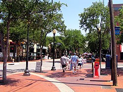
 Tourists in the West End stroll down Market Street | |
 Location in Dallas | |
| Country | United States |
| State | Texas |
| Counties | Dallas |
| City | Dallas |
| Area | Downtown |
| Elevation | 423 ft (129 m) |
| ZIP code | 75202 |
| Area code(s) | 214, 469, 972 |
| Website | West End Historic District |
Westend Historic District | |
Dallas Landmark Historic District
| |
| Location | Bounded by Lamar, Griffin, Wood, Market, and Commerce Sts., Dallas, Texas |
| Coordinates | 32°46′44″N 96°48′21″W / 32.77889°N 96.80583°W |
| Area | 67.5 acres (27.3 ha) |
| Built | 1891 |
| Architect | Multiple |
| Architectural style | Chicago, Late 19th and Early 20th Century American Movements, Romanesque |
| NRHP reference No. | 78002918[1] |
| DLMKHD No. | H/2 |
| Significant dates | |
| Added to NRHP | November 14, 1978 |
| Designated DLMKHD | October 6, 1975[2] |
The West End Historic District of Dallas, Texas, is a historic district that includes a 67.5-acre (27.3 ha) area in northwest downtown, generally north of Commerce, east of I-35E, west of Lamar and south of the Woodall Rodgers Freeway. It is south of Victory Park, west of the Arts, City Center, and Main Street districts, and north of the Government and Reunion districts. A portion of the district is listed on the U.S. National Register of Historic Places as Westend Historic District. A smaller area is also a Dallas Landmark District. The far western part of the district belongs to the Dealey Plaza Historic District, a National Historic Landmark around structures and memorials associated with the assassination of John F. Kennedy.
- ^ "National Register Information System". National Register of Historic Places. National Park Service. November 2, 2013.
- ^ Staff (August 4, 2016). "West End Historic District" (PDF). Department of Urban Planning, City of Dallas. p. 3. Retrieved August 2, 2018.

