West Livingston, Texas | |
|---|---|
 | |
 | |
| Coordinates: 30°42′43″N 95°00′08″W / 30.71194°N 95.00222°W | |
| Country | |
| State | |
| County | Polk |
| Area | |
| • Total | 24.0 sq mi (62.1 km2) |
| • Land | 23.9 sq mi (62.0 km2) |
| • Water | 0.0 sq mi (0.1 km2) |
| Elevation | 148 ft (45 m) |
| Population (2020) | |
| • Total | 8,156 |
| • Density | 340/sq mi (130/km2) |
| Time zone | UTC-6 (Central (CST)) |
| • Summer (DST) | UTC-5 (CDT) |
| ZIP code | 77351[2] |
| Area code | 936 |
| FIPS code | 48-77662[3] |
| GNIS feature ID | 2409553[1] |
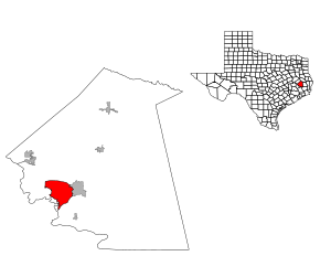
West Livingston is a census-designated place (CDP) in western Polk County, Texas, United States, located along the eastern shore of Lake Livingston 6 miles (9.7 km) west of central Livingston.[4] The population was 8,156 at the 2020 census.
- ^ a b U.S. Geological Survey Geographic Names Information System: West Livingston, Texas
- ^ "West Livingston ZIP Code". zipdatamaps.com. 2023. Retrieved January 12, 2023.
- ^ "U.S. Census website". United States Census Bureau. Retrieved January 31, 2008.
- ^ "West Livingston, Texas." Handbook of Texas. Retrieved on May 9, 2010.