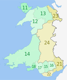
West Wales and the Valleys is a UK International Territorial Level 2 statistical region covering the western areas of Wales and the South Wales Valleys. Created as part of the Eurostat's Nomenclature of Territorial Units for Statistics (NUTS), it was used to by the European Union (EU) to deliver the European Regional Development Fund to areas of Wales, until the UK's withdrawal from the EU in 2020. Following which it was mirrored onto the Office for National Statistics' International Territorial Level (ITL) geoclassification system. The remainder of Wales is part of the East Wales statistical region.