Westchester, Florida | |
|---|---|
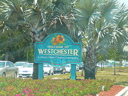
 Sign marking entrance to Westchester on Bird Road, just west of the Palmetto Expressway | |
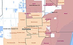
 Map of Westchester CDP after merging with University Park CDP in 2020 | |
| Coordinates: 25°44′49″N 80°20′13″W / 25.74694°N 80.33694°W | |
| Country | |
| State | |
| County | |
| Established | 1860 |
| Area | |
| • Total | 8.11 sq mi (20.99 km2) |
| • Land | 7.95 sq mi (20.60 km2) |
| • Water | 0.15 sq mi (0.40 km2) |
| Elevation | 8 ft (2 m) |
| Population | |
| • Total | 56,384 |
| • Density | 7,089.65/sq mi (2,737.34/km2) |
| Time zone | UTC-5 (Eastern (EST)) |
| • Summer (DST) | UTC-4 (EDT) |
| ZIP Codes | 33144, 33155, 33165, 33174, 33175 (all Miami) |
| Area code(s) | 305, 786, 645 |
| FIPS code | 12-76075[3] |
| GNIS feature ID | 2403012 |
Westchester is a census-designated place (CDP) and neighborhood in Miami-Dade County, Florida. It is part of the Miami metropolitan area of South Florida. Prior to the 2020 U.S. Census, the neighboring University Park CDP was merged into Westchester CDP, effectively doubling its geography and population.[4] Per the 2020 census, the population was 56,384.[2]
- ^ "2022 U.S. Gazetteer Files: Florida". United States Census Bureau. Retrieved January 17, 2023.
- ^ a b "P1. Race – Westchester CDP, Florida: 2020 DEC Redistricting Data (PL 94-171)". U.S. Census Bureau. Retrieved January 17, 2023.
- ^ "U.S. Census website". United States Census Bureau. Retrieved 2008-01-31.
- ^ "2020 Geography Changes". United States Census Bureau. Retrieved May 15, 2022.
Compare the following:- "2020 CENSUS - CENSUS BLOCK MAP: Westchester CDP, FL" (PDF). U.S. Census Bureau. Retrieved 2022-09-28.
- "2010 CENSUS - CENSUS BLOCK MAP: Westchester CDP, FL" (PDF). U.S. Census Bureau. Retrieved 2022-09-28.
- "2010 CENSUS - CENSUS BLOCK MAP: University Park CDP, FL" (PDF). U.S. Census Bureau. Retrieved 2022-09-28.