This article needs additional citations for verification. (March 2020) |
Western New York | |
|---|---|
Region | |
|
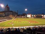
Left to right from top: Buffalo's skyline, Rochester's skyline, Niagara Falls in the winter, Letchworth State Park in autumn, the 2008 NHL Winter Classic at Highmark Stadium, a nighttime game at Frontier Field. | |
 Western New York counties | |
| Country | United States |
| State | New York |
| Region | Western New York |
| Counties | Allegany, Cattaraugus, Chautauqua, Erie, Genesee, Livingston, Monroe, Niagara, Ontario, Orleans, Schuyler, Seneca, Steuben, Wayne, Wyoming, Yates |
| Cities | Buffalo, Rochester, Niagara Falls, Batavia, Jamestown, Lockport, Canandaigua, North Tonawanda, Geneva |
| Area | |
• Total | 15,107 sq mi (39,130 km2) |
| Population (2017) | |
• Total | 2,800,878 |
| • Density | 190/sq mi (72/km2) |
| Time zone | UTC−5 (Eastern Standard Time) |
| • Summer (DST) | UTC−4 (Eastern Daylight Time) |
| Area code | 315, 585, 607, 716 |
| Part of a series on |
| Regions of New York |
|---|
 |
Western New York (WNY) is the westernmost region of the U.S. state of New York. The eastern boundary of the region is not consistently defined by state agencies or those who call themselves "Western New Yorkers". Almost all sources agree WNY includes the cities of Buffalo, Niagara Falls, Jamestown, and the surrounding suburbs, as well as the outlying rural areas of Niagara Frontier, and Chautauqua-Alleghany (or the western Southern Tier). Many would also place Rochester and the Genesee Valley in the region, although those legally belong in the Finger Lakes Region and are separate from Western New York Region.
The State of New York sometimes defines the WNY region as including just five counties: Allegany, Cattaraugus, Chautauqua, Erie, and Niagara. The state's Empire State Development Corporation and state health authorities have both mapped the region this way.[1] The state has also used this regional boundary to set policy during the COVID-19 pandemic.[2]
More commonly, WNY has been defined to include at least Genesee, Orleans, and Wyoming counties as well. Almost all descriptions of WNY in the Buffalo media market define it as this 8 county area.[3] Most organizations that use WNY in their name including the WNY College Consortium, the WNY Genealogical Society, WNY PRISM, the Psychological Association of WNY, and the WNY Land Conservancy describe themselves as working in these 8 counties.[4][5][6][7][8]
Others, such as Clarion Publications, the publisher of the WNY Travel Guide and WesternNY.com, have used the term Western New York to describe a much larger area consisting of 17 counties. In addition to those counties mentioned, they add Chemung, Livingston, Monroe, Ontario, Schuyler, Seneca, Steuben, Wayne, and Yates as well.[9]
The rest of this article uses that definition. The 17 counties have a land area of 11,764 square miles (30,470 km2).[9] They include the area of the Holland Purchase and the Phelps and Gorham Purchase.
The area is primarily served by Buffalo and Rochester media markets, although there is considerable overlap between these two markets, as well as other American and Canadian media markets (particularly from nearby Toronto). In terms of the combined statistical areas used by the United States Census Bureau, Western New York consists of the Buffalo-Cheektowaga-Olean, NY area, the Rochester-Batavia-Seneca Falls, NY area, and the Elmira-Corning, NY area.[10]
Western New York is in some contexts considered a sub-region of "Upstate New York" (when that term is used to describe all of New York State outside Long Island and the New York City metropolitan area); in most cases however, New Yorkers identify by specific regionalities such as Western New York or Central New York in preference to the vague and broader term Upstate New York.
- ^ "Welcome to Empire State Development". esd.ny.gov. 2016-10-24. Retrieved 2021-08-05.
- ^ "WNY not yet ready". observertoday.com. Retrieved 2021-08-05.
- ^ Pignataro, T. J. "Tracking change in the five climate zones of Western New York". The Buffalo News. Retrieved 2021-08-05.
- ^ "Western New York". www.wnycollegeconnection.com. Retrieved 2021-08-05.
- ^ "Western New York Genealogical Society". www.wnygs.org. Retrieved 2021-08-05.
- ^ "Western New York Wildway". WNYLC. Retrieved 2021-08-05.
- ^ "Western New York PRISM". Western New York PRISM. Retrieved 2021-08-06.
- ^ "PAWNY - Psychological Association of Western New York". www.pawny.org. Retrieved 2021-08-06.
- ^ a b "The regions of Western New York". Genesee Country Magazine: Western New York Travel Guide/Clarion Publications, Inc. 2008. Retrieved 1 July 2014.
- ^ "NEW YORK - Core Based Statistical Areas (CBSAs) and Counties" (PDF). United States Census Bureau. 2013-03-01. Retrieved 2018-04-06.


