Western United States
American West, Far West, the West | |
|---|---|
|
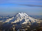
Left-right from top: Los Angeles skyline, the Grand Canyon, Yellowstone National Park, Boise skyline, Angel's Landing, Mt. Rainier, Seattle skyline | |
![This map reflects the Western United States as defined by the Census Bureau. This region is divided into Mountain and Pacific areas.[1]](http://upload.wikimedia.org/wikipedia/commons/thumb/3/3c/Map_of_the_U.S.%2C_highlighting_the_West.svg/250px-Map_of_the_U.S.%2C_highlighting_the_West.svg.png) This map reflects the Western United States as defined by the Census Bureau. This region is divided into Mountain and Pacific areas.[1] | |
| Subregions | |
| Country | United States |
| States |
|
| Area | |
• Total | 1,873,251.63 sq mi (4,851,699.4 km2) |
| • Land | 1,751,053.31 sq mi (4,535,207.3 km2) |
| Population | |
• Total | 78,588,572 |
| • Density | 42/sq mi (16/km2) |
| Demonym | Westerner |
| GDP (nominal) | |
| • Total | $5.619 trillion (2019) |
| • per capita | $71,719 (2019) |
The Western United States (also called the American West, the Western States, the Far West, the Western territories, and the West) is one of the four census regions defined by the United States Census Bureau.
As American settlement in the U.S. expanded westward, the meaning of the term the West changed. Before around 1800, the crest of the Appalachian Mountains was seen as the western frontier. The frontier moved westward and eventually the lands west of the Mississippi River were considered the West.[5]
The U.S. Census Bureau's definition of the 13 westernmost states includes the Rocky Mountains and the Great Basin to the Pacific Coast, and the mid-Pacific islands state, Hawaii. To the east of the Western United States is the Midwestern United States and the Southern United States, with Canada to the north and Mexico to the south.
The West contains several major biomes, including arid and semi-arid plateaus and plains, particularly in the American Southwest; forested mountains, including three major ranges, the Sierra Nevada, the Cascades, and Rocky Mountains; the long coastal shoreline of the American Pacific Coast; and the rainforests of the Pacific Northwest.
- ^ a b Cite error: The named reference
CensusRegionsMapwas invoked but never defined (see the help page). - ^ "United States Summary: 2010, Population and Housing Unit Counts, 2010 Census of Population and Housing" (PDF). United States Census Bureau. September 2012. pp. V–2, 1 & 41 (Tables 1 & 18). Retrieved February 7, 2014.
- ^ "Change in Resident Population of the 50 States, the District of Columbia, and Puerto Rico: 1910 to 2020" (PDF). Census.gov. United States Census Bureau. Retrieved June 13, 2021.
- ^ "BEA Glossary". Bureau of Economic Analysis. U.S. Department of Commerce. Archived from the original on September 28, 2017. Retrieved June 8, 2017.
- ^ Jody Halsted (July 31, 2014). "On the road along the Mississippi River". Foxnews. Archived from the original on August 2, 2014. Retrieved November 8, 2015.


