Westmere | |
|---|---|
 | |
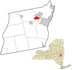
 Location in Albany County and the state of New York. | |
| Coordinates: 42°41′29″N 73°52′34″W / 42.69139°N 73.87611°W | |
| Country | United States |
| State | New York |
| Region | Capital District |
| County | Albany |
| Settled | 1920s |
| Area | |
| • Total | 3.18 sq mi (8.23 km2) |
| • Land | 3.17 sq mi (8.21 km2) |
| • Water | 0.01 sq mi (0.03 km2) |
| Elevation | 292 ft (89 m) |
| Population (2020) | |
| • Total | 7,560 |
| • Density | 2,385.61/sq mi (921.03/km2) |
| Time zone | UTC-5 (EST) |
| • Summer (DST) | UTC-4 (EDT) |
| ZIP Code | 12203, 12084, 12159 |
| Area code | 518 |
| FIPS code | 36-80423[2] |
| GNIS feature ID | 0970925[3] |
Westmere is a hamlet in the town of Guilderland, Albany County, New York, United States. Since the 1970 Census, a census-designated place (CDP) has been established with the name of Westmere for tabulating the population of what the census has defined as the boundaries for Westmere. The population was 7,284 at the 2010 census.[4] It is a suburb of the neighboring city of Albany. U.S. Route 20 (Western Avenue) bisects the community and is the major thoroughfare and main street. Along Western Avenue are numerous strip malls, shopping plazas, and commercial buildings, with residential use on the side streets to the north and south. Crossgates Mall, the Capital District's largest shopping mall, is in Westmere's northeastern corner.
- ^ "ArcGIS REST Services Directory". United States Census Bureau. Retrieved September 20, 2022.
- ^ "U.S. Census website". United States Census Bureau. Retrieved January 31, 2008.
- ^ "US Board on Geographic Names". United States Geological Survey. October 25, 2007. Retrieved January 31, 2008.
- ^ "Race, Hispanic or Latino, Age, and Housing Occupancy: 2010 Census Redistricting Data (Public Law 94-171) Summary File (QT-PL), Westmere CDP, New York". United States Census Bureau. Retrieved August 31, 2011.