This article has multiple issues. Please help improve it or discuss these issues on the talk page. (Learn how and when to remove these messages)
|
Westport | |
|---|---|
 Westport, Baltimore, MD 21230, USA | |
| Coordinates: 39°15′48.24″N 76°38′2.76″W / 39.2634000°N 76.6341000°W | |
| Country | United States |
| State | Maryland |
| City | Baltimore |
| Time zone | UTC-5 (Eastern) |
| • Summer (DST) | EDT |
| ZIP code | 21230 |
| Area code | 410, 443, and 667 |
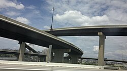
Westport is a neighborhood in south Baltimore, Maryland. Westport is a majority African-American neighborhood that has struggled with crime, housing abandonment, and unemployment in the past decade. The neighborhood is bordered by the Middle Branch of the Patapsco River on the east, the city neighborhoods of Cherry Hill, Brooklyn and the southwestern Baltimore County community of Lansdowne to the southwest, Hollins Ferry Road and the Mount Winans and Lakeland neighborhoods to the west, and Interstate 95 to the north, along with the South Baltimore communities of Federal Hill and Otterbein. The Baltimore–Washington Parkway (Maryland Route 295) runs through the middle of Westport and intersects with Interstate 95, the main East Coast super-highway, north to south, Maine to Florida.
