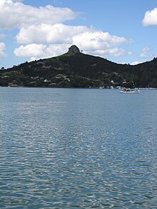

Whangaroa Harbour (/ˈfæŋəroʊ.ə/; Māori pronunciation: [faŋaɾɔa]), previously spelled Wangaroa Harbour, is an inlet on the northern coast of Northland, New Zealand. Whangaroa Bay and the Pacific Ocean are to the north. The small settlements of Totara North and Saies are on the west side of the harbour, Waitaruke on the south side, and Whangaroa on the east. State Highway 10 runs through Waitaruke.[1][2] The name comes from the lament "Whaingaroa" or "what a long wait" of a woman whose warrior husband had left for a foray to the south.[3] The harbour was formed when rising sea levels drowned a river valley about 6,000 years ago. Steep outcrops remain from ancient volcanic rocks.[4]
There are extensive mangrove swamps at the head of the harbour,[5] and some of the oldest fossils in the North Island, dating to the Early Permian about 270 million years ago, are in the Whangaroa area.[6]
- ^ Peter Dowling, ed. (2004). Reed New Zealand Atlas. Reed Books. pp. map 3. ISBN 0-7900-0952-8.
- ^ Roger Smith, GeographX (2005). The Geographic Atlas of New Zealand. Robbie Burton. pp. map 18. ISBN 1-877333-20-4.
- ^ Sale, E. V. (1986). Whangaroa. pp. 1–2. ISBN 0-473-00387-2.
- ^ "Whangaroa Harbour". Te Ara: The Encyclopedia of New Zealand.
- ^ "Whangaroa and district". Te Ara: The Encyclopedia of New Zealand.
- ^ "Oldest fossils – Paleozoic". Te Ara: The Encyclopedia of New Zealand.
