White Bluffs, Washington | |
|---|---|
 Remains of the Hudson's Bay Company post at White Bluffs, ca. 1937 | |
| Coordinates: 46°39′59″N 119°29′05″W / 46.6665256°N 119.4847477°W[1] | |
| Country | United States |
| State | Washington |
| County | Benton |
| Elevation | 413 ft (126 m) |
| Time zone | UTC-8 (Pacific (PST)) |
| • Summer (DST) | UTC-7 (PDT) |
| ZIP code | 98944 |
| Area code | 509 |
| GNIS feature ID | 1531180[1] |
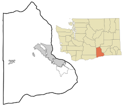
White Bluffs was an agricultural town in Benton County, Washington, United States. It was depopulated in 1943 along with the town of Hanford to make room for the nuclear production facility known as the Hanford Site.
- ^ a b c "White Bluffs". Geographic Names Information System. United States Geological Survey, United States Department of the Interior. Retrieved October 25, 2012.
- ^ "U.S. Census website". United States Census Bureau. Retrieved January 31, 2008.
