| White Coppice | |
|---|---|
 White Coppice Cricket Ground | |
Location within Lancashire | |
| OS grid reference | SD616190 |
| Civil parish | |
| District | |
| Shire county | |
| Region | |
| Country | England |
| Sovereign state | United Kingdom |
| Post town | CHORLEY |
| Postcode district | PR6 |
| Dialling code | 01257 |
| Police | Lancashire |
| Fire | Lancashire |
| Ambulance | North West |
| UK Parliament | |
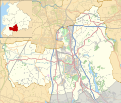
White Coppice is a hamlet near Chorley, Lancashire, England. It was the most populated part of the township of Anglezarke in the 19th century. Close to the settlement in the early 19th century were quarries and small coal mines. The hamlet lies to the north of Anglezarke Reservoir in the Rivington reservoir chain built to provide water for Liverpool in the mid 19th century.[1][2] To the south west is a hill known as Healey Nab.
White Coppice had a cotton mill at the start of the Industrial Revolution. Its mill lodge provided water for a steam engine, and before that the mill was powered by a waterwheel on the Black Brook. Around 1900 the mill was owned by Alfred Ephraim Eccles, a supporter of the Temperance movement.[3]
- ^ Rivington Reservoirs, Pastscape, retrieved 17 June 2010
- ^ Rivington Reservoirs (main scheme), Engineering Timelines, archived from the original on 23 February 2012, retrieved 16 December 2010
- ^ White Coppice walk, Lancashire Telegraph, retrieved 16 December 2010

