40°01′26″N 123°56′35″W / 40.02389°N 123.94306°W
Whitethorn, California | |
|---|---|
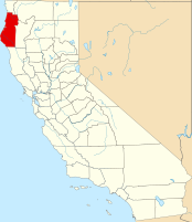
 Location in the state of California | |
| Coordinates: 40°01′26″N 123°56′35″W / 40.02389°N 123.94306°W | |
| Country | United States |
| State | California |
| County | Humboldt County |
| Elevation | 1,024 ft (312 m) |
Whitethorn (formerly Thorn) is an unincorporated community in Humboldt County, California, United States.[1] It is located 9.5 miles (15 kilometers) southwest of Garberville,[2] at an elevation of 1,024 feet (312 meters), with a population of 817.[1] Whitethorn shares a ZIP Code, 95589, with Shelter Cove, California. It is located along California's Lost Coast.[3]
- ^ a b c U.S. Geological Survey Geographic Names Information System: Whitethorn, California
- ^ Durham, David L. (1998). California's Geographic Names: A Gazetteer of Historic and Modern Names of the State. Clovis, Calif.: Word Dancer Press. p. 167. ISBN 1-884995-14-4.
- ^ USPS ZIP Code lookup tool
