This article needs additional citations for verification. (November 2013) |
Whitla | |
|---|---|
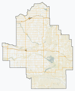
Location of Whitla in County of Forty Mile No. 8 | |
| Coordinates: 49°52′50″N 111°03′29″W / 49.880443°N 111.058108°W | |
| Country | Canada |
| Province | Alberta |
| Region | Southern Alberta |
| Census division | No. 1 |
| Municipal district | County of Forty Mile No. 8 |
| Government | |
| • Type | Unincorporated |
| • Reeve | Steven Wikkerink |
| • Governing body | County of Forty Mile Council |
| Elevation | 791 m (2,595 ft) |
| Time zone | UTC-7 (Mountain Time Zone) |
| • Summer (DST) | UTC-6 (Mountain Time Zone) |
Whitla is a hamlet in Alberta, Canada that is under the jurisdiction of the County of Forty Mile No. 8.[1] It is approximately 32 km (20 mi) southwest of the City of Medicine Hat and 1.6 km (0.99 mi) north of Highway 3. As of completion of an expansion in December 2021, Capital Power Corporation operates Alberta's largest wind farm in the area, with 353MW capacity.[2]
- ^ "Specialized and Rural Municipalities and Their Communities" (PDF). Alberta Municipal Affairs. June 3, 2024. Retrieved June 14, 2024.
- ^ Gallant, Collin (December 4, 2021). "Whitla Wind, now Alberta's largest, online since Dec. 1". Medicine Hat News. Retrieved February 8, 2022.

