Whitley County | |
|---|---|
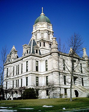
 Whitley County courthouse in Columbia City | |
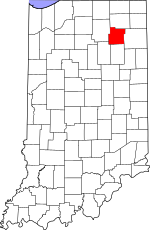
 Location within the U.S. state of Indiana | |
 Indiana's location within the U.S. | |
| Coordinates: 41°08′N 85°30′W / 41.14°N 85.5°W | |
| Country | |
| State | |
| Founded | February 7, 1835 (authorized) 1838 (organized) |
| Named for | William Whitley |
| Seat | Columbia City |
| Largest city | Columbia City |
| Area | |
• Total | 337.91 sq mi (875.2 km2) |
| • Land | 335.57 sq mi (869.1 km2) |
| • Water | 2.34 sq mi (6.1 km2) 0.69% |
| Population (2020) | |
• Total | 34,191 |
| • Density | 101.6/sq mi (39.2/km2) |
| Time zone | UTC−5 (Eastern) |
| • Summer (DST) | UTC−4 (EDT) |
| Congressional district | 3rd |
| Website | whitleygov |
| Indiana county number 92 Last alphabetical county in Indiana. | |
Whitley County is a rural county in the U.S. state of Indiana. As of the 2020 United States census, the population was 36,825.[1] Whitley County is the 49th largest county in Indiana. The county seat (and only incorporated city) is Columbia City.[2] The county has the highest county number (92) on Indiana license plates, as it is alphabetically the last in the state's list of counties. It is part of the Fort Wayne Metropolitan Statistical Area and the Fort Wayne–Huntington–Auburn Combined Statistical Area.
- ^ https://www.census.gov/quickfacts/fact/table/whitleycountyindiana/PST045219 [dead link]
- ^ "Find a County". National Association of Counties. Retrieved June 7, 2011.