Wichita County | |
|---|---|
 The Wichita County Courthouse in downtown Wichita Falls | |
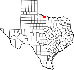
 Location within the U.S. state of Texas | |
 Texas's location within the U.S. | |
| Coordinates: 33°59′N 98°43′W / 33.99°N 98.71°W | |
| Country | |
| State | |
| Founded | February 1, 1882 |
| Seat | Wichita Falls |
| Largest city | Wichita Falls |
| Area | |
• Total | 633 sq mi (1,640 km2) |
| • Land | 628 sq mi (1,630 km2) |
| • Water | 5.3 sq mi (14 km2) 0.8% |
| Population (2020) | |
• Total | 129,350 |
• Estimate (2022) | 129,978 |
| • Density | 200/sq mi (79/km2) |
| Time zone | UTC−6 (Central) |
| • Summer (DST) | UTC−5 (CDT) |
| Congressional district | 13th |
| Website | wichitacountytx |
Wichita County (/ˈwɪtʃɪtɔː/ WITCH-ih-taw) is a county located in the U.S. state of Texas. As of the 2020 census, its population was 129,350.[1] The county seat is Wichita Falls.[2] The county was created in 1858 and organized in 1882.[3] Wichita County is part of the Wichita Falls, Texas, TX metropolitan statistical area.
- ^ "State & County QuickFacts". United States Census Bureau. Retrieved December 17, 2023.
- ^ "Find a County". National Association of Counties. Retrieved June 7, 2011.
- ^ "Texas: Individual County Chronologies". Texas Atlas of Historical County Boundaries. The Newberry Library. 2008. Retrieved May 27, 2015.