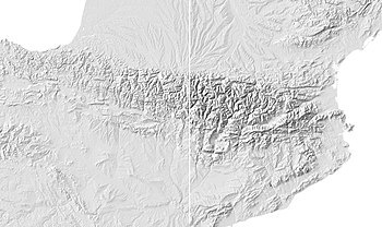
This tutorial's aim is to optimize relief shadows of previously created shaded reliefs using digital elevation model (DEM) files and the programs 3DEM or GRASS GIS.

Composite: In many cases, a single illumination source is inadequate for showing the main forms of a relief, particularly if the relief features are oriented North-West - South-East in the axis of the main light source. In order to improve the result, it is possible to displace the virtual Sun across the map and create three views which will be assembled together to produce a composite shadow image of the map in question.

Bumping: This page proposes a second optimization which could be applied to general maps covering a country. Where, on a large scale map such as those resulting from the files of the Shuttle Radar Topography Mission (SRTM) at their native resolution, each detail of the relief is clearly visible and useful. In the other hand, more general map don't need the level of precision of the SRTM, but raher the principal forms which are of more interest.