This article relies largely or entirely on a single source. (October 2019) |
Wilkes-Barre Wyoming Valley Airport | |||||||||||||||
|---|---|---|---|---|---|---|---|---|---|---|---|---|---|---|---|
 Wilkes-Barre Wyoming Valley Airport in the early 20th century | |||||||||||||||
| Summary | |||||||||||||||
| Airport type | Public | ||||||||||||||
| Owner | Luzerne County, Pennsylvania, U.S. | ||||||||||||||
| Serves | Wilkes-Barre/Scranton metropolitan area (Wyoming Valley) | ||||||||||||||
| Elevation AMSL | 543 ft / 166 m | ||||||||||||||
| Coordinates | 41°17′50″N 075°51′08″W / 41.29722°N 75.85222°W | ||||||||||||||
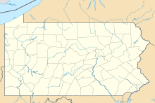
| Map | |||||||||||||||
Location of airport in Pennsylvania | |||||||||||||||
 | |||||||||||||||
| Runways | |||||||||||||||
| |||||||||||||||
| Statistics (2011) | |||||||||||||||
| |||||||||||||||
Wilkes-Barre Wyoming Valley Airport (IATA: WBW, ICAO: KWBW, FAA LID: WBW) is a county-owned, public airport located in Forty Fort and Wyoming in Luzerne County, Pennsylvania.[2] The National Plan of Integrated Airport Systems for 2011–2015 categorized it as a general aviation facility. The primary airport of the Wilkes-Barre/Scranton metropolitan area is the Wilkes-Barre/Scranton International Airport (AVP).[citation needed]
- ^ FAA Airport Form 5010 for WBW PDF. Federal Aviation Administration. Effective May 31, 2012.
- ^ Cite error: The named reference
tlwas invoked but never defined (see the help page).

