William L. Whitehurst Field | |||||||||||
|---|---|---|---|---|---|---|---|---|---|---|---|
 | |||||||||||
| Summary | |||||||||||
| Airport type | Public | ||||||||||
| Owner | Hardeman County | ||||||||||
| Serves | Bolivar, Tennessee | ||||||||||
| Elevation AMSL | 499 ft / 152 m | ||||||||||
| Coordinates | 35°12′52″N 089°02′36″W / 35.21444°N 89.04333°W | ||||||||||
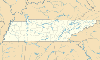
| Map | |||||||||||
 | |||||||||||
| Runways | |||||||||||
| |||||||||||
| Statistics (2019) | |||||||||||
| |||||||||||
William L. Whitehurst Field (FAA LID: M08) is a county-owned, public-use airport located four nautical miles (7 km) southwest of the central business district of Bolivar, a city in Hardeman County, Tennessee, United States.[1]
- ^ a b FAA Airport Form 5010 for M08 PDF, effective 2023-08-10

