Williams County | |
|---|---|
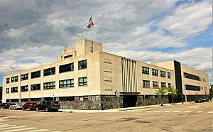
 Williams County Courthouse | |
 Location within the U.S. state of North Dakota | |
 North Dakota's location within the U.S. | |
| Coordinates: 48°21′N 103°29′W / 48.35°N 103.48°W | |
| Country | |
| State | |
| Founded | 1891 |
| Named for | Erastus Appleman Williams |
| Seat | Williston |
| Largest city | Williston |
| Area | |
• Total | 2,148 sq mi (5,560 km2) |
| • Land | 2,077 sq mi (5,380 km2) |
| • Water | 70 sq mi (200 km2) 3.3% |
| Population (2020) | |
• Total | 40,950 |
• Estimate (2023) | 39,113 |
| • Density | 19/sq mi (7.4/km2) |
| Time zone | UTC−6 (Central) |
| • Summer (DST) | UTC−5 (CDT) |
| Congressional district | At-large |
| Website | www |
Williams County is located on the western border of the U.S. state of North Dakota, next to Montana. As of the 2020 census, the population was 40,950.[1] making it the fifth most populous county in North Dakota. Its county seat is Williston.[2]
The Williston Micropolitan Statistical Area includes all of Williams County. It is bordered on the south by the upper Missouri River, whose confluence with its tributary Yellowstone River is located just east of the border with Montana.
- ^ "State & County QuickFacts". United States Census Bureau. Retrieved March 18, 2024.
- ^ "Find a County". National Association of Counties. Retrieved June 7, 2011.