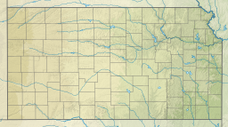
| Wilson Lake | |
|---|---|
 Wilson Dam (1999) | |
 | |
| Location | Russell and Lincoln counties in Kansas |
| Coordinates | 38°56′25″N 98°33′24″W / 38.94028°N 98.55667°W |
| Type | Reservoir |
| Primary inflows | Saline River |
| Primary outflows | Saline River |
| Catchment area | 1,917 sq mi (4,970 km2) |
| Basin countries | United States |
| Managing agency | U.S. Army Corps of Engineers |
| Built | April 1961 |
| First flooded | December 29, 1964 |
| Max. length | 24 miles (39 km) |
| Surface area | 9,045 acres (36.60 km2) |
| Max. depth | 65 ft (20 m)[1] |
| Water volume | Full: 242,528 acre⋅ft (299,154,000 m3)[2] Current (Nov. 2015): 156,100 acre⋅ft (192,500,000 m3)[3] |
| Shore length1 | 100 mi (160 km) |
| Surface elevation | Full: 1,516 ft (462 m)[2] Current (May. 2019): 1,523 ft (464 m)[3] |
| Settlements | Dorrance, Lucas, Sylvan Grove, Wilson |
| References | [4] |
| 1 Shore length is not a well-defined measure. | |
Wilson Lake is a reservoir in the U.S. state of Kansas, on the border of Russell County and Lincoln County.[5] Built and managed by the U.S. Army Corps of Engineers for flood control, it is also used for wildlife management and recreation. Several parks are located along its shoreline, including Wilson State Park.[6]
- ^ "Wilson Reservoir Fishing Information". Kansas Department of Wildlife, Parks and Tourism. Retrieved 2015-11-09.
- ^ a b Cite error: The named reference
Volumewas invoked but never defined (see the help page). - ^ a b Cite error: The named reference
Conditionswas invoked but never defined (see the help page). - ^ "Wilson Lake". Geographic Names Information System. United States Geological Survey, United States Department of the Interior. October 13, 1978. Retrieved January 15, 2021.
- ^ Cite error: The named reference
KDOTwas invoked but never defined (see the help page). - ^ Cite error: The named reference
Learnwas invoked but never defined (see the help page).

