| Wilson River | |
|---|---|
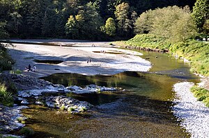
 Wilson River from Oregon Route 6 bridge near Tillamook | |
| Location | |
| Country | United States |
| State | Oregon |
| County | Tillamook County |
| Physical characteristics | |
| Source | Northern Oregon Coast Range |
| • location | East of Tillamook |
| • coordinates | 45°36′22″N 123°27′45″W / 45.60611°N 123.46250°W[1] |
| • elevation | 871 ft (265 m)[2] |
| Mouth | Tillamook Bay |
• location | Oregon |
• coordinates | 45°28′44″N 123°53′24″W / 45.47889°N 123.89000°W[1] |
• elevation | 0 ft (0 m)[1] |
| Length | 33 mi (53 km)[3] |
| Basin size | 194 sq mi (500 km2)[4] |
| Discharge | |
| • average | 1,177 cu ft/s (33.3 m3/s)[5] |
| • minimum | 32 cu ft/s (0.91 m3/s) |
| • maximum | 38,600 cu ft/s (1,090 m3/s) |
The Wilson River, about 33 miles (53 km) long, flows from the Northern Oregon Coast Range to Tillamook Bay in the U.S. state of Oregon. Formed by the confluence of its Devil's Lake Fork and its South Fork, it runs generally west through the Tillamook State Forest to its mouth near the city of Tillamook.[3][6] It is one of five rivers—the Tillamook, the Trask, the Wilson, the Kilchis, and the Miami—that flow into the bay.[7]
- ^ a b c "Wilson River". Geographic Names Information System (GNIS). United States Geological Survey. November 28, 1980. Retrieved November 14, 2009.
- ^ Source elevation derived from Google Earth search using GNIS source coordinates.
- ^ a b United States Geological Survey. "United States Geological Survey Topographic Map: Woods Point, Jordan Creek, Trask, The Peninsula, and Tillamook quadrants". TopoQuest. Retrieved November 14, 2009. The maps include river mile (RM) markers from the river's mouth to its source near Elk Creek Campground.
- ^ "Wilson River Basin". Tillamook Bay Watershed Council. Retrieved November 11, 2009.
- ^ "USGS Water Data Report 2008: 14301500 Wilson River near Tillamook, OR" (PDF). United States Geological Survey. Retrieved November 19, 2009.
- ^ Oregon Atlas and Gazetteer (Map) (2008 ed.). DeLorme Mapping. §§ 20, 21, and 26. ISBN 978-0-89933-347-2.
- ^ "Five Rivers". Tillamook Bay Watershed Council. Retrieved November 14, 2009.
