| Wind River Wild River, Bighorn River | |
|---|---|
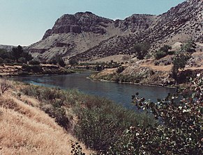
 Wind River Canyon downstream from Boysen Dam | |
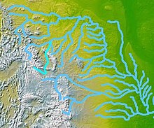
 The Wind-Bighorn rivers | |
| Location | |
| Country | United States |
| State | Wyoming |
| Cities | Dubois, Crowheart, Johnstown, Riverton |
| Physical characteristics | |
| Source | Two Ocean Mountain |
| • location | Wind River Range, Teton County |
| • coordinates | 43°44′50″N 110°04′27″W / 43.74722°N 110.07417°W[1] |
| • elevation | 9,760 ft (2,970 m) |
| Mouth | Bighorn River |
• location | Wedding of the Waters, Hot Springs County |
• coordinates | 43°34′52″N 108°12′44″W / 43.58111°N 108.21222°W[1] |
• elevation | 4,472 ft (1,363 m) |
| Length | 185 mi (298 km) |
| Basin size | 7,730 sq mi (20,000 km2) |
| Discharge | |
| • location | below Boysen Dam[2] |
| • average | 1,357 cu ft/s (38.4 m3/s)[2] |
| • minimum | 4.7 cu ft/s (0.13 m3/s) |
| • maximum | 28,700 cu ft/s (810 m3/s) |
| Basin features | |
| Tributaries | |
| • left | East Fork Wind River |
| • right | Dinwoody Creek, Bull Lake Creek, Little Wind River |
The Wind River is the name applied to the upper reaches of the Bighorn River in Wyoming in the United States. The Wind River is 185 miles (298 km)[3] long. The two rivers are sometimes referred to as the Wind/Bighorn.
- ^ a b "Wind River". Geographic Names Information System. United States Geological Survey, United States Department of the Interior. 1979-06-05. Retrieved 2011-04-05.
- ^ a b "USGS Gage #06259000 on the Wind River below Boysen Reservoir, WY" (PDF). National Water Information System. U.S. Geological Survey. Retrieved 2011-04-05.
- ^ "The National Map". U.S. Geological Survey. Retrieved February 17, 2011.