| Roblin Boulevard Corydon Avenue | ||||
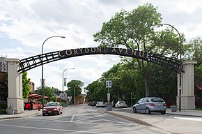
 Corydon Avenue arch | ||||
| Route information | ||||
| Maintained by City of Winnipeg | ||||
| Length | 10.8 km[1] (6.7 mi) | |||
| Existed | 1966–present | |||
| Known for | Confusion Corner, Little Italy | |||
| Major junctions | ||||
| West end | Route 105 (Grant Ave) | |||
| East end | Route 42 / Route 62 | |||
| Location | ||||
| Country | Canada | |||
| Province | Manitoba | |||
| Highway system | ||||
| ||||
Route 95 is a city route located in Winnipeg, Manitoba. It runs in the southwest part of the city from Route 105 east to Route 42, near the Confusion Corner intersection. It is named Roblin Boulevard west of Assiniboine Park, where it then becomes Corydon Avenue for the remainder of its route.[2]
- ^ "Route 95 in Winnipeg, Manitoba" (Map). Google Maps. Retrieved November 22, 2021.
- ^ Sherlock Publishing (2016). Sherlock's Map of Winnipeg (Map) (20th ed.). Winnipeg: Sherlock Publishing. pp. 17, 22–24. ISBN 1-895229-84-7.
