Winslow West, Arizona | |
|---|---|
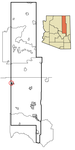
 Location in Navajo County and the state of Arizona | |
| Coordinates: 35°00′53″N 110°42′49″W / 35.01472°N 110.71361°W | |
| Country | United States |
| State | Arizona |
| Counties | Navajo, Coconino |
| Area | |
| • Total | 17.20 sq mi (44.55 km2) |
| • Land | 17.20 sq mi (44.54 km2) |
| • Water | 0.00 sq mi (0.01 km2) |
| Elevation | 4,967 ft (1,514 m) |
| Population (2020) | |
| • Total | 457 |
| • Density | 26.57/sq mi (10.26/km2) |
| Time zone | UTC-7 (MST) |
| FIPS code | 04-83960 |
| GNIS feature ID | 2409612[2] |
Winslow West is a census-designated place (CDP) in Navajo and Coconino counties in Arizona, United States.[3] The population was 438 at the 2010 census.[4] The entire community is off-reservation trust land belonging to the Hopi Tribe of Arizona. It lies just west of the city of Winslow, and is more than 50 km (31 mi) south of the main Hopi Reservation.
- ^ "2020 U.S. Gazetteer Files". United States Census Bureau. Retrieved October 29, 2021.
- ^ a b U.S. Geological Survey Geographic Names Information System: Winslow West, Arizona
- ^ "2020 CENSUS - CENSUS BLOCK MAP: Winslow West CDP, AZ" (PDF). U.S. Census Bureau. Retrieved September 12, 2024.
- ^ "Profile of General Population and Housing Characteristics: 2010 Demographic Profile Data (DP-1): Winslow West CDP, Arizona". United States Census Bureau. Retrieved December 8, 2011.
