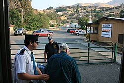
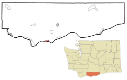
Wishram, Washington | |
|---|---|
 Passengers deboarding the Empire Builder at Wishram station | |
 Location of Wishram in Klickitat County, Washington | |
| Coordinates: 45°39′40″N 120°57′32″W / 45.66111°N 120.95889°W | |
| Country | United States |
| State | Washington |
| County | Klickitat |
| Area | |
• Total | 1.3 sq mi (3.3 km2) |
| • Land | 1.3 sq mi (3.3 km2) |
| • Water | 0.0 sq mi (0.0 km2) |
| Elevation | 177 ft (54 m) |
| Population (2020) | |
• Total | 366 |
| • Density | 290/sq mi (110/km2) |
| Time zone | UTC-8 (Pacific (PST)) |
| • Summer (DST) | UTC-7 (PDT) |
| ZIP code | 98673 |
| Area code | 509 |
| FIPS code | 53-79485[1] |
| GNIS feature ID | 1528268[2] |
Wishram is an unincorporated community and census-designated place (CDP) in Klickitat County, Washington, United States. The population was 366 at the 2020 census. The site of the historic Celilo Falls is nearby.
The community was originally named "Fallbridge"; it was changed to "Wishram" to honor the Wishram tribe of Native Americans.[3] The Dalles Dam, 9 miles (14 km) downstream on the Columbia River, was completed in 1957, and began filling Lake Celilo. The original fishing village near this location was inundated.
- ^ "U.S. Census website". United States Census Bureau. Retrieved January 31, 2008.
- ^ "Wishram". Geographic Names Information System. United States Geological Survey, United States Department of the Interior.
- ^ Vogt, Tom (November 9, 2014). "Company town celebrates 100 years". The Columbian. Retrieved May 6, 2019.