| Witton Cemetery | |
|---|---|
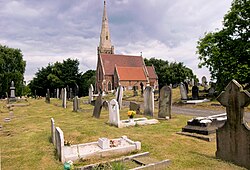
 Chapel near the highest point | |
 | |
| Details | |
| Established | 1863 |
| Location | |
| Country | England |
| Coordinates | 52°31′30″N 1°52′43″W / 52.5249°N 1.8787°W |
| Owned by | Birmingham City Council |
| Website | www |
| Find a Grave | Witton Cemetery |


Witton Cemetery (grid reference SP082921), which opened in Witton in 1863 as Birmingham City Cemetery, is the largest cemetery in Birmingham, England. Covering an area of 103 acres (0.42 km2), it once had three chapels; however, two of these were demolished in 1980. The cemetery would perform up to 20 burials a day; however, it was declared "full to capacity" in December 2013, allowing burials only in existing family plots, or of babies or cremated remains.[1] Extra capacity was therefore provided at the nearby New Hall Cemetery.[1] The cemetery office was opened in 1999.