This article has multiple issues. Please help improve it or discuss these issues on the talk page. (Learn how and when to remove these messages)
|
| A4150 | ||||
|---|---|---|---|---|
| Wolverhampton Inner Ring Road | ||||
 A4150 - Wolverhampton Ring Road | ||||
| Route information | ||||
| Length | 2.3 mi (3.7 km) | |||
| Major junctions | ||||
| Southwest end | Wolverhampton | |||
| South end | Wolverhampton | |||
| Location | ||||
| Country | United Kingdom | |||
| Road network | ||||
| ||||
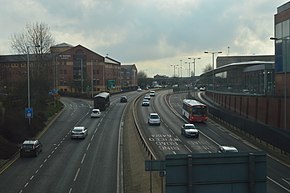
The A4150 Wolverhampton Inner Ring Road is a ring road that encircles the city centre of Wolverhampton in the West Midlands, England. The circumference of the road is around 2.1 miles (3.4 km). Technically, the route is listed as an "Inner Ring Road", although only a tiny section of the "Outer Ring Road" was ever constructed with only one of the two designed carriageways built. A second carriageway was built in 2017 along a short stretch between Patshull Avenue and Stafford Road. The section of outer ring road is called Wobaston Road and locally classified by Wolverhampton City Council as U119.[citation needed]
