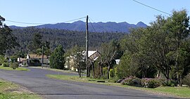
| Woodenbong New South Wales | |
|---|---|
 Woodenbong | |
| Coordinates | 28°23′0″S 152°36′0″E / 28.38333°S 152.60000°E |
| Population | 390 (2021 census)[1] |
| Postcode(s) | 2476 |
| Elevation | 402 m (1,319 ft) |
| Location | |
| LGA(s) | Kyogle Council |
| State electorate(s) | Lismore |
| Federal division(s) | New England, Page |
Woodenbong is a rural village in the Kyogle Shire of northern New South Wales. It is situated 10 km south of the Queensland border and five kilometres south of the junction of the Summerland Way and the Mount Lindesay Road, which leads to Legume and eventually Tenterfield. At the 2021 census Woodenbong had a population of 390.[1]
It is 798 km north-east of Sydney, 145 km from Brisbane and 60 km north-west of Kyogle.
- ^ a b Australian Bureau of Statistics (28 June 2022). "Woodenbong (L) (Urban Centre/Locality)". 2021 Census QuickStats. Retrieved 18 March 2023.
