Woodstock, New York | |
|---|---|
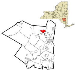
 U.S. Census Map | |
 Location in Ulster County and the state of New York. | |
| Coordinates: 42°2′25″N 74°7′2″W / 42.04028°N 74.11722°W | |
| Country | United States |
| State | New York |
| County | Ulster |
| Area | |
• Total | 6.85 sq mi (17.75 km2) |
| • Land | 6.84 sq mi (17.73 km2) |
| • Water | 0.01 sq mi (0.02 km2) |
| Elevation | 561 ft (171 m) |
| Population (2020) | |
• Total | 2,521 |
| • Density | 368.35/sq mi (142.22/km2) |
| Time zone | UTC-5 (Eastern (EST)) |
| • Summer (DST) | UTC-4 (EDT) |
| ZIP code | 12498 |
| Area code | 845 |
| FIPS code | 36-83041[2] |
| GNIS feature ID | 0971721[3] |
Woodstock is a hamlet (and census-designated place) in Ulster County, New York, United States. The population was 2,521 according to the 2020 census. The community of Woodstock is in the eastern part of the Town of Woodstock and is northwest of Kingston. It is located along NY 212 near its junction with NY 375. Although the name of the community and the town lent its name to the Woodstock Festival, that event did not take place in Woodstock.
- ^ "ArcGIS REST Services Directory". United States Census Bureau. Retrieved September 20, 2022.
- ^ "U.S. Census website". United States Census Bureau. Retrieved January 31, 2008.
- ^ "US Board on Geographic Names". United States Geological Survey. October 25, 2007. Retrieved January 31, 2008.