This article has multiple issues. Please help improve it or discuss these issues on the talk page. (Learn how and when to remove these messages)
|
Worcester
Woester in Afrikaans orthography | |
|---|---|
|
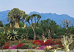
From top, High Street in the Worcester downtown area. Karoo Desert National Botanical Garden (centre left). Kleinplasie Historical Village (centre right). A historic home (bottom left). The Worcester Dutch Reformed Church (bottom right). | |
| Coordinates: 33°38′42″S 19°26′37″E / 33.64500°S 19.44361°E | |
| Country | South Africa |
| Province | Western Cape |
| District | Cape Winelands |
| Municipality | Breede Valley |
| Established | 1820[1] |
| Government | |
| Area | |
• Total | 73.2 km2 (28.3 sq mi) |
| Population (2020)[2] | |
• Total | 127,597 |
| • Density | 1,700/km2 (4,500/sq mi) |
| Racial makeup (2011) | |
| • Black African | 25.4% |
| • Coloured | 55.7% |
| • Indian/Asian | 0.8% |
| • White | 17.0% |
| • Other | 1.1% |
| First languages (2011) | |
| • Afrikaans | 73.1% |
| • Xhosa | 19.1% |
| • English | 3.7% |
| • Sotho | 1.7% |
| • Other | 2.4% |
| Time zone | UTC+2 (SAST) |
| Postal code (street) | 6850 |
| PO box | 6849 |
| Area code | 023 |
| Website | www |
Worcester (/ˈwʊstər/ WUUST-ər) is a town in the Western Cape, South Africa. It is the third-largest city in the Western Cape Province of South Africa. It is located 120 kilometres (75 mi) north-east of Cape Town on the N1 highway north to Johannesburg.
Being the largest town in the Western Cape's interior region, it serves as the administrative capital of the Breede Valley Local Municipality and as regional headquarters for most central and Provincial Government Departments. Its mayor is Antoinette Steyn. The town also serves as the hub of the Western Cape's interior commercial, distribution and retail activity with a shopping mall, well developed central business district and infrastructure.
Worcester is located at an elevation of 220 metres (720 ft) and can be reached by road either travelling on the N1 highway through the Huguenot Tunnel or by driving through spectacular mountain passes. From Cape Town Du Toitskloof, from Wellington Bainskloof, from Malmesbury, Western Cape Nieuwekloof, from Ceres Mitchells, from Robertson Goree, from Hermanus Rooihoogte and from Johannesburg Hex River, with vistas over the Hex River Valley.
Geographically, the district is delimited mainly by mountains; to the southwest lies the massive Stettyns mountain range with an annual rainfall in excess of 2000 mm. To the west lie the Du Toitskloof Mountains and northwest lies the Slanghoek, Little Drakenstein, Elandskloof and Lemiet mountain ranges. To the north rises the Hex River Mountains which include the towering peaks of Chavonnes, Brandwacht, Fonteintjiesberg and Audensberg. Northeast of the town the colourful Keerom Mountain runs into the Langeberg range.
Worcester and its surroundings form part of the Breede River catchment area, which is fed by a number of smaller rivers supplemented by the run-off from the winter snows in the mountains. The district also includes the Hex River Valley.
- ^ Robson, Linda Gillian (2011). "Annexure A" (PDF). The Royal Engineers and settlement planning in the Cape Colony 1806–1872: Approach, methodology and impact (PhD thesis). University of Pretoria. pp. xlv–lii. hdl:2263/26503.
- ^ a b c d Sum of the Main Places Zweletemba and Worcester from Census 2011.


