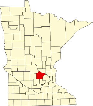
Wright County | |
|---|---|
 | |
 Location within the U.S. state of Minnesota | |
 Minnesota's location within the U.S. | |
| Coordinates: 45°11′N 93°58′W / 45.18°N 93.97°W | |
| Country | |
| State | |
| Founded | February 20, 1855[1] |
| Named for | Silas Wright |
| Seat | Buffalo |
| Largest city | Otsego |
| Area | |
• Total | 714 sq mi (1,850 km2) |
| • Land | 661 sq mi (1,710 km2) |
| • Water | 53 sq mi (140 km2) 7.4% |
| Population (2020) | |
• Total | 141,337 |
• Estimate (2023) | 151,150 |
| • Density | 213.8/sq mi (82.5/km2) |
| Time zone | UTC−6 (Central) |
| • Summer (DST) | UTC−5 (CDT) |
| Congressional district | 6th |
| Website | www |
Wright County is a county in the East Central part of the U.S. state of Minnesota. As of the 2020 census, the population was 141,337.[2] Its county seat is Buffalo.[3] The county was founded in 1855. Wright County is part of the Minneapolis-St. Paul-Bloomington, MN-WI Metropolitan Statistical Area. In terms of population, Wright County is the tenth-largest county in Minnesota and the fastest growing.
- ^ "Minnesota Place Names". Minnesota Historical Society. Archived from the original on June 20, 2012. Retrieved March 19, 2014.
- ^ "State & County QuickFacts". United States Census Bureau. Retrieved April 10, 2023.
- ^ "Find a County". National Association of Counties. Retrieved June 7, 2011.