| Wrightington | |
|---|---|
 | |
Location within Lancashire | |
| Population | 2,886 (2011 census) |
| OS grid reference | SD536126 |
| Civil parish |
|
| District | |
| Shire county | |
| Region | |
| Country | England |
| Sovereign state | United Kingdom |
| Post town | WIGAN |
| Postcode district | WN6 |
| Dialling code | 01257 |
| Police | Lancashire |
| Fire | Lancashire |
| Ambulance | North West |
| UK Parliament | |
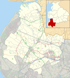
Wrightington is a civil parish in West Lancashire, England, with an area of 3,915½ acres. The surface is hilly, rising to over 400 ft. at Harrock on the border of Parbold, and then falling to the north, northeast and southeast. On the southern border, the boundary at Appley Bridge touches the River Douglas. Wrightington Hall is to the north of this point. Tunley and Broadhurst lie to the north of the park, and Fairhurst, to the west of Harrock, reaches down to the River Douglas. At the 2001 census, Wrightington had a population of 4,055,[1] falling to 2,886 at the 2011 Census.[2]
- ^ "Area: Wrightington (Ward)". Neighbourhood.statistics.gov.uk. Retrieved 18 April 2015.
- ^ UK Census (2011). "Local Area Report – Wrightington Parish (E0400531)". Nomis. Office for National Statistics. Retrieved 26 March 2021.

