Wrightstown, Wisconsin | |
|---|---|
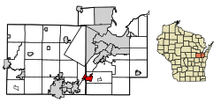
 Location of Wrightstown in Brown & Outagamie Counties, Wisconsin. | |
| Coordinates: 44°19′34″N 88°10′32″W / 44.32611°N 88.17556°W | |
| Country | |
| State | |
| Counties | Brown, Outagamie |
| Area | |
• Total | 4.52 sq mi (11.71 km2) |
| • Land | 4.31 sq mi (11.17 km2) |
| • Water | 0.21 sq mi (0.53 km2) |
| Elevation | 709 ft (216 m) |
| Population | |
• Total | 3,179 |
• Estimate (2024)[4] | 3,303 |
| • Density | 813.17/sq mi (313.99/km2) |
| Time zone | UTC-6 (Central (CST)) |
| • Summer (DST) | UTC-5 (CDT) |
| Area code | 920 |
| FIPS code | 55-89175[5] |
| GNIS feature ID | 1584484[2] |
| Website | vil |
Wrightstown is a village in Brown and Outagamie counties in the U.S. state of Wisconsin. The population was 3,179 at the 2020 census. The village is surrounded mostly by the westernmost part of the Town of Wrightstown in Brown County. On February 28, 2002, the village annexed a portion of land within the adjacent Town of Kaukauna in Outagamie County.[6]
Wrightstown is part of the Green Bay Metropolitan Statistical Area.
- ^ "2019 U.S. Gazetteer Files". United States Census Bureau. Retrieved August 7, 2020.
- ^ a b "US Board on Geographic Names". United States Geological Survey. October 25, 2007. Retrieved January 31, 2008.
- ^ Cite error: The named reference
wwwcensusgovwas invoked but never defined (see the help page). - ^ Cite error: The named reference
USCensusEst2019CenPopScriptOnlyDirtyFixDoNotUsewas invoked but never defined (see the help page). - ^ "U.S. Census website". United States Census Bureau. Retrieved January 31, 2008.
- ^ "Archived copy" (PDF). Archived from the original (PDF) on April 19, 2009. Retrieved April 5, 2006.
{{cite web}}: CS1 maint: archived copy as title (link)