Wydown/Skinker | |
|---|---|
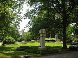
 Memorial Presbyterian Church (foreground) and the Missouri Historical Society (aft, in a former synagogue) are both located in the small neighborhood of Wydown/Skinker. | |
 Location (red) of Wydown/Skinker within St. Louis | |
| Country | United States |
| State | Missouri |
| City | St. Louis |
| Wards | 28 |
| Area | |
| • Total | 0.13 sq mi (0.3 km2) |
| Population (2020)[1] | |
| • Total | 1,121 |
| • Density | 8,600/sq mi (3,300/km2) |
| ZIP code(s) | Part of 63105 |
| Area code(s) | 314 |
| Website | stlouis-mo.gov |
Wydown/Skinker is a neighborhood in St. Louis, Missouri. Washington University in St. Louis is located just north of this neighborhood. The neighborhood is bounded by the city limits on the west, Forsyth Boulevard on the north, Forest Park (Skinker Blvd.) on the east and Clayton Avenue on the south.[2] The Missouri Historical Society Library & Research Center is located in the Wydown/Skinker neighborhood.