| Wyong Central Coast, New South Wales | |||||||||||||||
|---|---|---|---|---|---|---|---|---|---|---|---|---|---|---|---|
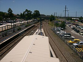
 Wyong railway station | |||||||||||||||
| Coordinates | 33°16′55″S 151°25′05″E / 33.282°S 151.418°E | ||||||||||||||
| Population | 4,530 (2021 census)[1] | ||||||||||||||
| • Density | 503/km2 (1,300/sq mi) | ||||||||||||||
| Postcode(s) | 2259 | ||||||||||||||
| Elevation | 22 m (72 ft) | ||||||||||||||
| Area | 9 km2 (3.5 sq mi) | ||||||||||||||
| Location |
| ||||||||||||||
| LGA(s) | Central Coast Council | ||||||||||||||
| Parish | Munmorah | ||||||||||||||
| State electorate(s) | Wyong | ||||||||||||||
| Federal division(s) | Dobell | ||||||||||||||
| |||||||||||||||
Wyong (/ˈwaɪɒŋ/) is a town on the Central Coast of New South Wales, Australia. It is located approximately 63 km SSW of Newcastle and 93 km NNE of the state capital Sydney. Established in 1888, it is one of the two administrative centres for the Central Coast Council local government area.
- ^ Australian Bureau of Statistics (28 June 2022). "Wyong". 2021 Census QuickStats. Retrieved 3 February 2024.
