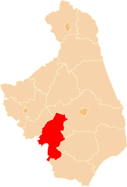
Wysokie Mazowieckie County
Powiat wysokomazowiecki | |
|---|---|
 Location within the voivodeship | |
| Coordinates (Wysokie Mazowieckie): 52°55′9″N 22°30′52″E / 52.91917°N 22.51444°E | |
| Country | |
| Voivodeship | Podlaskie |
| Seat | Wysokie Mazowieckie |
| Gminas | |
| Area | |
| • Total | 1,288.49 km2 (497.49 sq mi) |
| Population (2019) | |
| • Total | 57,051 |
| • Density | 44/km2 (110/sq mi) |
| • Urban | 18,849 |
| • Rural | 38,202 |
| Car plates | BWM |
| Website | http://wysokomazowiecki.pl/ |
Wysokie Mazowieckie County (Polish: powiat wysokomazowiecki) is a unit of territorial administration and local government (powiat) in Podlaskie Voivodeship, north-eastern Poland. It came into being on January 1, 1999, as a result of the Polish local government reforms passed in 1998. Its administrative seat and largest town is Wysokie Mazowieckie, which lies 49 kilometres (30 mi) south-west of the regional capital Białystok. The only other towns in the county are Ciechanowiec, lying 27 km (17 mi) south of Wysokie, Szepietowo, 6 km (4 mi) south of Wysokie, and as from 1 January 2011 Czyżew.
The county covers an area of 1,288.49 square kilometres (497.5 sq mi). As of 2019 its total population was 57,051, out of which the population of Wysokie Mazowieckie was 9,415, that of Ciechanowiec 4,631, that of Czyżew 2,633, that of Szepietowo 2,170, and the rural population 38,202.[1]
- ^ GUS. "Population. Size and structure and vital statistics in Poland by territorial division in 2019. As of 30th June". stat.gov.pl. Retrieved 2020-09-14.

