This article needs additional citations for verification. (November 2020) |
Xiangkhouang province
ແຂວງ ຊຽງຂວາງ | |
|---|---|
 Phonsavan Hills | |
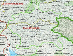
 Map of Xiangkhouang province | |
 Location of Xiangkhouang province in Laos | |
| Coordinates: 19°25′0″N 103°30′0″E / 19.41667°N 103.50000°E | |
| Country | Laos |
| Capital | Phonsavan |
| Area | |
• Total | 14,751 km2 (5,695 sq mi) |
| Population (2020 census) | |
• Total | 267,172 |
| • Density | 18/km2 (47/sq mi) |
| Time zone | UTC+7 (ICT) |
| ISO 3166 code | LA-XI |
| HDI (2017) | high · 2nd |
Xiangkhouang (Lao: ຊຽງຂວາງ, meaning 'Horizontal City') is a province of Laos on the Xiangkhoang Plateau, in the nation's northeast.[2] The province has the distinction of being the most heavily-bombed place on Earth.[3]
Historically, the province was formerly the independent principality of Muang Phuan. Its present capital is Phonsavan. The population of the province as of the 2015 census was 244,684.[4]
Xiangkhouang province covers an area of 15,880 square kilometres (6,130 sq mi) and is mountainous. Apart from floodplains, the largest area of level land in the country is on the province's Xiangkhoang Plateau. The plateau is characterized by rolling hills and grassland whose elevation averages 1,300 metres (4,300 ft). The country's highest peak, Phou Bia (2,820 metres (9,250 ft)), rises at the south side of the plateau. Nam Et-Phou Louey is a National Biodiversity Conservation Area (NBCA) in the province, covering an area of 5,959 km2, and overlaps into Houaphanh and Luang Prabang provinces.
The province's Plain of Jars was designated as a UNESCO World Heritage Site in 2019.[5]
- ^ "Sub-national HDI - Area Database - Global Data Lab". hdi.globaldatalab.org. Retrieved 13 September 2018.[not specific enough to verify]
- ^ "Base Map:Lao People's Democratic Republic (LPDR". UNOSAT. Retrieved 4 December 2012.
- ^ Gilhooly, Rob (5 July 2000). "The Plain of Jars: A place of war and death". The Japan Times. Retrieved 16 May 2020.
- ^ "Provinces of Laos". Statoids. Retrieved 1 November 2012.
- ^ "Megalithic Jar Sites in Xiengkhuang – Plain of Jars". UNESCO. Retrieved 24 April 2021.