Yana-Indigirka Lowland
Яно-Индигирская низменность | |
|---|---|
 | |
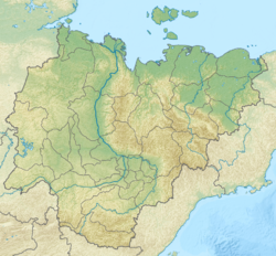
Location in Sakha, Russian Far East | |
| Coordinates: 71°N 142°E / 71°N 142°E | |
| Location | Sakha Republic, Russia |
| Part of | Yana-Kolyma Lowland |
| Area | |
| • Total | 95,000 km2 (37,000 sq mi) |
| Dimensions | |
| • Length | 600 kilometers (370 mi) |
| • Width | 300 kilometers (190 mi) |
| Elevation | 80 meters (260 ft) |
The Yana-Indigirka Lowland (Russian: Яно-Индигирская низменность; Yakut: Дьааҥы - Индигир намтала) is a large, low alluvial plain located in northern Siberia, Far Eastern Federal District, Russia.
Administratively most of the territory of the lowland is part of the Sakha Republic (Yakutia). There are inhabited centers of population in the lowlands such as Chokurdakh, Olenegorsk and Nizhneyansk, but these are very few and scattered.
