| Yarkand River | |
|---|---|
 Yarkand River | |
| Location | |
| Country | China |
| Province | Xinjiang |
| Physical characteristics | |
| Source | North Siachen Muztagh, Karakoram range at an Altitude of 7,462 m (24,482 ft) |
| • coordinates | 35°32′53″N 77°28′58″E / 35.547983°N 77.482907°E |
| 2nd source | East Siachen Muztagh, North Rimo Glacier |
| • coordinates | 35°29′17″N 77°26′52″E / 35.488°N 77.4479°E |
| 3rd source | Karakoram_Pass |
| • coordinates | 35°30′48″N 77°49′22″E / 35.51346°N 77.8227°E |
| • elevation | 5539 |
| Mouth | |
• location | Tarim River or Neinejoung River |
• coordinates | 38°25′00″N 77°21′36″E / 38.416667°N 77.36°E |
| Length | 1,332.25 km (827.82 mi) |
| Basin size | 98,900 km2 (38,200 sq mi) |
| Discharge | |
| • average | 210 m3/s (7,400 cu ft/s) |
| Basin features | |
| Progression | Tarim→ Taitema Lake |
| Landmarks | Yarkand |
| Tributaries | |
| • left | Shaksgam, Tashkurgan, Kashgar |
| • right | Aktagh River |
| Waterbodies | Altash Water Conservancy Project (Midstream Reservoir) |
| Yarkand River | |||||||||||
|---|---|---|---|---|---|---|---|---|---|---|---|
| Uyghur name | |||||||||||
| Uyghur | يەكەن دەرياسى | ||||||||||
| |||||||||||
| Chinese name | |||||||||||
| Traditional Chinese | 葉爾羌河 | ||||||||||
| Simplified Chinese | 叶尔羌河 | ||||||||||
| |||||||||||
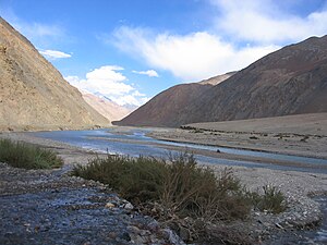
The Yarkand River (or Yarkent River, Yeh-erh-ch'iang Ho) is a river in the Xinjiang Uyghur Autonomous Region of western China. It originates in the Siachen Muztagh in a part of the Karakoram range and flows into the Tarim River or Neinejoung River, with which it is sometimes identified.[clarification needed] However, in modern times, the Yarkand river drains into the Midstream Reservoir and exhausts its supply without reaching the Tarim river. The Yarkand River is approximately 1,332.25 km (827.82 mi) in length, with an average discharge of 210 m3/s (7,400 cu ft/s).
A part of the river valley is known to the Kyrgyz people as Raskam Valley, and the upper course of the river itself is called the Raskam River.[1] Another name of the river is Zarafshan.[2] The area was once claimed by the ruler of Hunza.
- ^ S.R. Bakshi, Kashmir through Ages ISBN 81-85431-71-X vol 1 p.22, in Google Books
- ^ NGIA GeoNames search
