| Yeongsan River | |
|---|---|
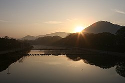
 Yeongsan River flowing through Damyang | |
 | |
| Native name | 영산강 (Korean) |
| Location | |
| Country | South Korea |
| Provinces | South Jeolla Province, Gwangju |
| Physical characteristics | |
| Source | Bukhacheon |
| • location | Byeongpung Mountain, Damyang, South Jeolla[c][3] |
| Mouth | Yellow Sea |
• location | Esturay Bank, Yeongam, South Jeolla Province[1] |
| Length | 129 km (80 mi)[1] |
| Basin size | 3,467 km2 (1,339 sq mi)[1] |
| Discharge | |
| • location | Naju Bridge, Naju[a][2] |
| • average | 48 m3/s (1,700 cu ft/s)[b][2] |
| Basin features | |
| Tributaries | |
| • left | Jiseokcheon |
| • right | Hwangnyong River, Gomagwoncheon, Hampyeongcheon |
 | |
| Yeongsan River | |
| Hangul | 영산강 |
|---|---|
| Hanja | 榮山江 |
| Revised Romanization | Yeongsangang |
| McCune–Reischauer | Yŏngsan'gang |
The Yeongsan River (Korean: 영산강; RR: Yeongsangang) is a river in south-western South Korea. It has a length of 129.50 km, and covers an area of 3,467.83 km2. It runs through Damyang, Naju, Gwangju and other regions and eventually flows into the Yellow Sea at Yeongam through the estuary bank.
- ^ a b c 2013년 한국하천일람 [List of Rivers of South Korea, 2013] (PDF) (in Korean). Han River Flood Control Office, Republic of Korea. 31 December 2012. pp. 282–283. Archived from the original (PDF) on 4 March 2016. Retrieved 25 July 2014.
- ^ a b 2014년 1월 월간 수자원 현황 및 전망 [Monthly Status & Predictions Report on Water Resources, January 2014] (in Korean). Han River Flood Control Office, Republic of Korea. 13 January 2014. p. 3. Archived from the original (HWP) on 15 July 2014. Retrieved 25 July 2014.
- ^ 2013년 한국하천일람 [List of Rivers of South Korea, 2013] (PDF) (in Korean). Han River Flood Control Office, Republic of Korea. 31 December 2012. pp. 22, 28, 32. Archived from the original (PDF) on 4 March 2016. Retrieved 25 July 2014.
Cite error: There are <ref group=lower-alpha> tags or {{efn}} templates on this page, but the references will not show without a {{reflist|group=lower-alpha}} template or {{notelist}} template (see the help page).