 Eastern portal of the Yerba Buena Tunnel, upper deck. Pictured in December 1994. | |
| Overview | |
|---|---|
| Other name(s) | Yerba Buena Island Tunnel |
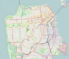
| Location | San Francisco, California |
| Coordinates | 37°48′34″N 122°21′56″W / 37.80944°N 122.36556°W |
| Route | |
| Crosses | Yerba Buena Island |
| Operation | |
| Work begun | July 9, 1933 |
| Constructed | 1933–36 |
| Opened | November 12, 1936 |
| Rebuilt | 1961–62 |
| Owner | Caltrans (District 4) |
| Traffic | automotive |
| Vehicles per day | 250,000 (2014)[1] |
| Technical | |
| Design engineer | Charles H. Purcell |
| Length | 540 ft (160 m) |
| No. of lanes | 10 |
| Tunnel clearance | 58 ft (18 m) |
| Width | 76 ft (23 m) |
The Yerba Buena Tunnel, also known as the Yerba Buena Island Tunnel, is a highway tunnel in San Francisco, California. It is the part of San Francisco–Oakland Bay Bridge complex that crosses Yerba Buena Island. The Yerba Buena Tunnel carries ten lanes of Interstate 80 (I-80) on two decks, connecting the two component spans of the Bay Bridge, the western suspension span and the eastern self-anchored suspension span. At the opening of the Bay Bridge in 1936, it was the world's largest-bore tunnel.
- ^ "San Francisco-Oakland Bay Bridge". Metropolitan Transportation Commission. Retrieved December 20, 2017.
FY 2014-15 Total toll-paid vehicles: 45,534,437


